I visited the Azores for a week in May 2006. Unfortunately the weather was not particularly good, which is not too surprising in the middle of the Atlantic. We had a depression coming through in the middle of the week, with low cloud/fog and no good views of the landscape which was a pity, especially on São Jorge.
[Click on the thumbnail for a bigger version of the photo].
Faial de Terra and Salto do Prego
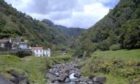
Faial de Terra valley. This is a secluded valley in the SE corner of São Miguel island, leading up to the Salto do Prego waterfall a couple of miles upstream. The vegetation is very lush sub-tropical “jungle”, though mostly of large bushes as the original large trees have all been felled. The local subspecies of grey wagtails were common along the water’s edge. |
 |
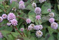
| Pink knotweed. At first I thought this was a very pretty pink clover with flower-heads about ¼" across but now I think it is Polygonum capitatum, an introduced plant which was common near the villages, growing on stony ground and old walls. |
 |
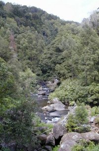
| Valley view. As you walk upstream the valley becomes steeper and narrower. |
 |
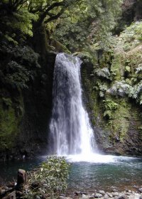
| Salto do Prega waterfall. Probably about 30ft high, in a shady spot surrounded by dense forest, including some tree ferns. There are over 200 species of ferns in the islands, where the damp, mild climate is ideal for them. |
 |
| Near Sanguinho. A view looking back up the valley from near the abandoned village of Sanguinho. |
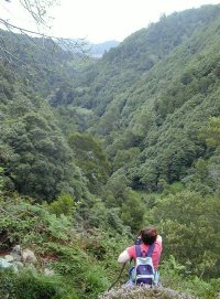 |
| View from Sanguinho. Looking out over the sea from Sanguinho – note the beautifully built track in the foreground, surfaced with basalt setts. |
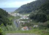 |
|
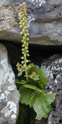
Navelwort, growing in a wall. |
 |
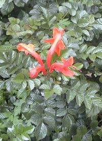
| Red flower in hedge. Spectacular red flowers well over an inch long, but I don’t know what they are... |
 |
Furnas
Tile map of Furnas. Furnas lies in the centre-east of São Miguel, inside a large volcanic crater or caldera. There are hot springs and fumaroles at the edge of town, and a larger group a couple of miles away on the shores of the crater lake. |
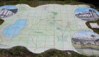 |
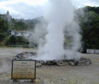
| Furnas hot spring. One of the hot springs in Furnas. The larger group out at the lake includes boiling mud and a small geyser-like fountain of hot water, as well as an area of hot mud in which local people bury cooking pots for 6-7 hours to cook the famous local dish of cozidos, a sort of casserole of vegetables and meat or fish. |
 |
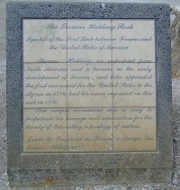
| Hickling’s rock. Thomas Hickling was an American who started the botanic gardens in Furnas as well as developing the town and its hot springs. |
 |
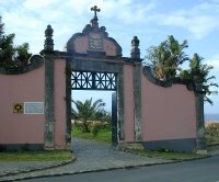
Around MaiaSolar de Lalem gateway. The splendid entrance to the converted manor house we stayed in. |
 |
| Solar de Lalem. The house seen from the gardens. Breakfast is taken under the umbrellas. |
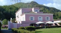 |
| Maia (view from hotel window). |
.jpg) |
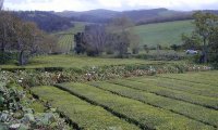
| Tea plantation. The Azores is the only place in Europe where tea is produced. These are rows of tea bushes, which can be seen extending up the hillside as well as in the foreground. The neat rows are harvested by machine these days. |
 |
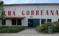
| Tea factory. I was amused that the Portuguese word for tea is Chá. You can visit this factory and see how the tea leaves are dried, fermented and packed, as well as taste the teas produced and buy packets of green, orange pekoe or broken leaf varieties. |
 |
| Cambridge recorder. One of the dials on a machine... |
 |
| Tea machine. An intriguing scale... |
 |
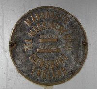
| Tea machine dial. Made in Lincolnshire! |
 |
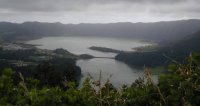
| Tile map of Vista do Rei. One of the most famous views on São Miguel, at the western end of the island, perched on the rim of a large volcanic crater or caldera. |
 |
| Crater lakes. As seen from the Vista do Rei. The thin line is a bridge. In the past the water of one lake was blue, the other green, but agricultural runoff has made both much the same colour. |
 |
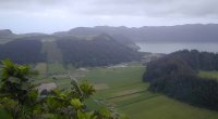
| View of caldera. Looking further round to the left, showing two smaller “dry craters” – smaller cones within the main caldera. |
 |
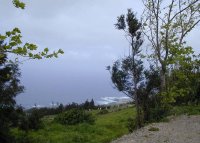
| View of sea from crater rim. The path along the crater rim is only about the width of a road, and if you turn around you can see the sea. Notice the sea stacks, and also some of the ubiquitous black and white cows in the middle-ground. |
 |
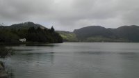
| Crater lake from the bridge. |
 |
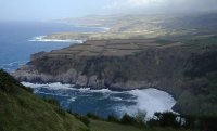
| Coastal view. From the road between Ribeira Grande and Maia. |
 |
| View of Vales. On São Jorge Island. We were staying in a converted farmhouse or Quinta across the bay from the port of Velas. There used to be a ferry connection but it does not run any more; it is a 5km trip by road. |
 |
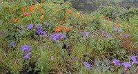
| Verge flowers. Red nasturtiums and blue morning glory growing wild. |
 |
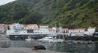
| Vales harbour. Mostly for fishing boats, but there is a small container port as well, and the inter-island ferry to Pico and Faial leaves from here too. |
 |
Capelinhos
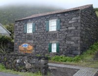
Capelinhos volcano museum. This small museum has displays relating to the 1957/8 eruption of a new volcanic cone at the western end of Faial, known as Capelinhos. The eruption started offshore, building up an island which later became joined to the main island. The ash produced buried several houses and damaged the lighthouse at the (original) end of the island, covering its base with at least 2m of debris. |
 |
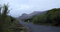
| View of Capelinhos. In the background is the barren landscape of the new volcano, where there is still very little vegetation cover. In the foreground there is low scrub and bamboo, but as you approach the volcano there is progressively less vegetation. The ruined lighthouse can be seen just left of centre. The noticeboard marks the boundary of the nature park that has been set up here. |
 |
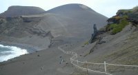
| Capelinhos volcano. As you approach the volcanic cone the landscape is very bare, with loose sand blowing about. The white fence marks a tern breeding colony on the seaward side. The faint path going up the hill in the middle of the picture is on the “bridge” of ash joining the new volcano to the old island. |
 |
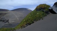
| Capelinhos. Another view, with some plants beginning to colonise the ash. |
 |
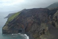
| Capelinhos volcanic cliffs. The new rock is being eroded very rapidly by the sea, forming steep cliffs. |
 |
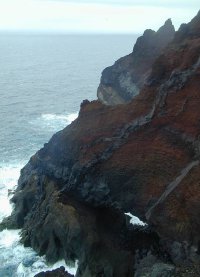
| Capelinhos cliffs. Some of the rock is brightly coloured. Softer bands are eroded out to form arches. |
 |
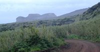
| View back to Capelinhos. This shows the scrubby vegetation with (introduced) bamboo that grows where the covering of volcanic ash was not so thick. The new volcano is in the background. |
 |
Horta, Faial island
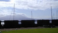
Pico from the Pousada in Horta. The island of Pico lies across the strait, and its volcanic cone is the highest mountain in the Azores (indeed in the whole of Portugal) at 2351m (7713ft). This view is from the window of our hotel room in the Pousada, which is inside the old fortress building. |
 |
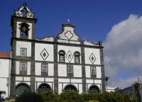
| Church in Horta. This white and black plaster and basalt construction is typical of both the Azores and Madeira. |
 |
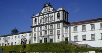
| Convent in Horta. Like many other buildings in the area this was largely rebuilt after the earthquake in 1998. |
 |
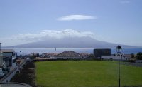
| Pico from Horta. A rare glimpse of the top of Pico! |
 |
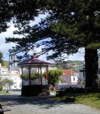
| Bandstand in Horta. Bandstands are common in parks and village squares throughout the islands. |
 |
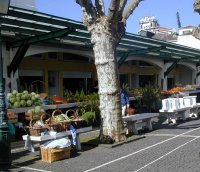
| Fruit market in Horta. This was in a pleasant market square lined with plane trees. The fruit and vegetable stalls were out in the open; meat and cheese stalls were behind in the low buildings, and there was a separate fish market at the end of the square. |
 |
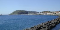
| Waterfront at Horta. |
 |
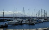
| Horta marina with Pico. Horta is an important centre for yachting. There were some very fine boats in the marina. |
 |
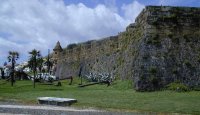
| Pousada fortress. A view of the outside of the fort that is now a Pousada hotel. |
 |
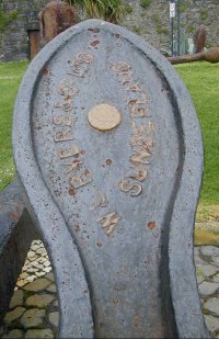
| Anchor. One of the large anchors on display outside the Pousada – all the way from Sunderland! |
 |
| Painted dockside in Horta. It is considered bad luck if visiting boats do not leave their name on the dock side... |
 |
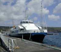
| Ferry boat. This is the twin-hulled boat that plies between the islands of São Jorge, Pico and Faial. |
 |
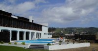
| Pool at Horta Pousada. |
 |
With the exception of the chaffinches, which were noticeably bluer than ours, the subspecies were “identified” by location – although the blackbirds and blackcaps both sounded subtly different from British birds as well.
I also saw sperm whales, bottle-nosed dolphins and a green turtle on a whale-watching trip; and more dolphins and a flying fish from the ferry between S. Jorge and Faial.


.jpg)


